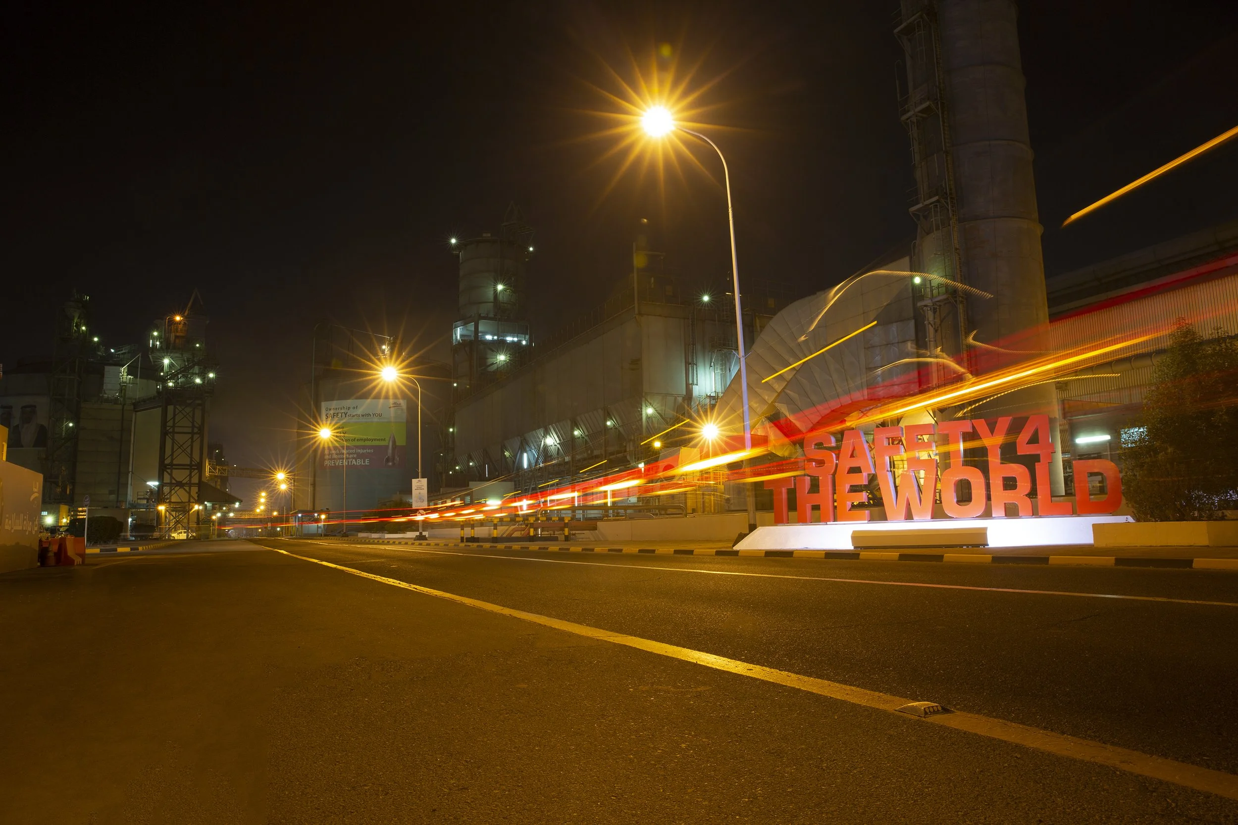
Infrastructure Decision Intelligence-Re-establishing Ground Reality in Critical Industrial Infrastructure
"A major industrial facility is never static. Over five decades of expansion, legacy engineering documentation can progressively decouple from physical ground reality."
How do you safeguard operational continuity across one of the world's largest single-site aluminium smelters? For Aluminium Bahrain B.S.C. (Alba), managing over 1.623 million metric tonnes of production per annum, operational safety is an absolute priority.
Yet, five decades of brownfield expansion create an underlying enterprise challenge: the "Subsurface Blind Spot." When what is documented no longer matches what physically exists under the ground, industrial assets face direct exposures—from catastrophic utility strikes to unplanned production downtime.
Our latest Case Study & Executive Briefing by Dr. Anirudha Kale highlights how GeoIntelliX Global deployed an integrated surface-to-subsurface reality capture framework at Alba. By shifting from historical assumptions to a high-precision spatial baseline, we demonstrate how heavy industry can build a trusted foundation for Infrastructure Decision Intelligence (IDI).
STRATEGIC CASE STUDY | EXECUTIVE BRIEFING
INFRASTRUCTURE DECISION INTELLIGENCE
Re-establishing Ground Reality to Strengthen Infrastructure Intelligence in Critical Industrial Infrastructure.
Target Enterprise: Aluminium Bahrain B.S.C. (Alba) | Kingdom of Bahrain
Sector: Heavy Industrial Infrastructure · Critical Assets · Operational Risk
Intelligence Domains: Subsurface Intelligence · Geospatial Intelligence · Reality Capture · Asset Information · Infrastructure Risk Governance
EXECUTIVE SUMMARY
In critical industrial environments, infrastructure does not remain static. The difference between what an engineering record says exists and what physically exists beneath the ground can become a significant operational and safety exposure.
Across decades of expansion, modification, maintenance, replacement and new development, the physical environment continuously evolves. Maintaining an increasingly accurate understanding of that environment therefore becomes an important dimension of operational, engineering and safety decision-making.
For Aluminium Bahrain B.S.C. (Alba), one of the world's largest single-site aluminium smelters in Kingdom of Bahrain, with production capacity exceeding 1.623 million metric tonnes per annum (mtpa), this challenge carries particular significance.
Guided by its corporate ethos, “Safety First, Safety Always,” Alba has maintained a strong focus on workforce safety, operational continuity and responsible management of its critical industrial environment.
Against this background, Alba made a strategically important decision: to establish a more comprehensive understanding of its physical infrastructure, above and below ground, and to progressively convert that knowledge into a structured digital and intelligence foundation.
ALBA's decision to establish a comprehensive surface-to-subsurface spatial baseline demonstrates an important principle of mature infrastructure leadership: the most valuable infrastructure information is not simply the information accumulated over time, but information that is deliberately established, verified and structured for the decisions ahead.
ALBA's investment in surface and subsurface reality capture, detailed spatial mapping, digital modelling and emerging infrastructure intelligence demonstrates an important direction for mature industrial infrastructure: moving from knowing where assets are to understanding the infrastructure environment as an integrated system.
That is where Infrastructure Decision Intelligence begins.
For a continuously evolving industrial facility, this creates a pathway from:
PHYSICAL REALITY → VERIFIED INFORMATION → DIGITAL REPRESENTATION → INFRASTRUCTURE INTELLIGENCE → BETTER DECISIONS
The ALBA initiative is therefore an example of how an industrial enterprise can move beyond maintaining records toward establishing a stronger and more enduring understanding of its physical infrastructure.
01 | THE ENTERPRISE CHALLENGE
Across a five-decade industrial environment, the physical reality of a major smelter continuously evolves. ALBA's decision to systematically establish and integrate that reality,above and below ground, represents an important step in strengthening the intelligence available to future engineering, operational and safety decisions.
Large industrial facilities are never static. Over decades, infrastructure is continuously:
Expanded
Modified
Rerouted
Repaired
Reconfigured
Replaced
Extended
Connected to new systems
Every intervention creates new information.
But unless that information is systematically incorporated into an authoritative and continuously maintained infrastructure record, an organisation gradually develops two versions of reality.
THE DOCUMENTED ENVIRONMENT
What drawings, CAD files, contractor records and historical as-builts indicate.
THE PHYSICAL ENVIRONMENT
What actually exists in the field.
The greater the divergence between these two environments, the greater the uncertainty surrounding future engineering and construction activity.
For underground infrastructure, this problem is particularly acute because physical verification is inherently difficult.
Four enterprise exposures emerge.
01 - INFORMATION DECAY AT PROJECT HANDOVER
Engineering data generated during capital projects can lose operational value when handover information becomes a collection of static CAD files, drawings and documents that do not adequately capture subsequent field modifications.
02 - THE SUBSURFACE BLIND SPOT
Surface plant topology can be observed and inspected continuously, while underground electrical networks, pipelines, duct banks, foundations and other buried assets remain largely invisible after construction.
03 - COMPOUND ENGINEERING CONTINGENCY
When brownfield projects operate on an uncertain spatial baseline, engineering teams must allow for unexpected utilities, design revisions, additional investigation, work interruptions and potential relocation.
04 - SAFETY AND OPERATIONAL EXPOSURE
An inaccurately represented underground asset can turn a routine excavation or civil intervention into a serious safety or operational event.
The fundamental problem is therefore not simply incomplete documentation.
It is insufficient confidence in the infrastructure information being used to make consequential decisions.
02 | THE ARCHITECTURE OF RISK
The subsurface is an information blind spot
A mature industrial facility may contain a dense and interconnected underground environment comprising:
High-voltage electrical networks
Cable corridors and duct banks
Industrial water systems
Process and utility pipelines
Drainage systems
Grounding networks
Foundations
Buried structures
Service connections
Previously modified infrastructure
Much of this infrastructure is invisible from the surface.
When legacy information is incomplete, inaccurate or disconnected, four forms of risk emerge.
01 - SAFETY EXPOSURE
Excavation without reliable knowledge of underground infrastructure can expose workers and contractors to high-energy electrical and other hazardous assets.
02 - OPERATIONAL EXPOSURE
Damage to critical utilities can interrupt plant operations and create unplanned outages or production disruption.
03 - PROJECT EXPOSURE
Unexpected infrastructure can result in redesign, work stoppage, contractor claims, schedule impacts and additional investigation.
04 - INFORMATION EXPOSURE
Every undocumented field modification increases the probability that the next engineering or construction intervention will begin from an inaccurate baseline.
This creates a fundamental infrastructure-management problem:
The organisation may own the physical asset, but it does not necessarily possess an equally reliable digital representation of that asset.
03 | THE STRATEGIC RESPONSE
Re-establishing ground reality
To establish a high-confidence spatial baseline across the facility, an integrated multi-sensor reality-capture and geophysical investigation methodology was deployed.
The objective was not simply to produce another survey.
It was to connect physical reality, spatial evidence and engineering information within a common reference framework.
01 - MULTI-SENSOR FUSION & FIELD ACQUISITION
Terrestrial & Mobile LiDAR
High-density spatial point clouds were captured across surface assets, structural elements and terrain to establish a detailed three-dimensional geometric record.
Ground Penetrating Radar (GPR)
Non-destructive subsurface investigation was undertaken to identify and locate underground utilities, duct banks and buried structures, including assets that could not be reliably identified from historical records alone.
Electromagnetic Locating (EML)
Signal tracing was used where appropriate to identify and confirm conductive infrastructure and critical utility routes.
Complementary Utility Investigation
Additional locating and tracing techniques were applied where required to strengthen understanding of underground networks and improve confidence in their spatial representation.
Existing Engineering Information
Historical drawings, CAD records and available documentation were treated as important information sources, but evaluated against physical evidence rather than automatically assumed to represent current reality.
This distinction is fundamental.
Existing records provide evidence of what was documented. Reality capture provides evidence of what exists.
04 | THE GEODETIC FOUNDATION
Establishing a common spatial reference
Surface & Subsurface intelligence is only as reliable as the spatial framework in which it is established.
A high-density localised geodetic control framework was therefore established across the plant.
This provided a common coordinate reference for integrating:
LiDAR point clouds
Surface assets
Subsurface investigation
Utility networks
Engineering information
Spatial relationships
Future infrastructure data
The resulting control framework achieved better than 2 mm spatial accuracy for the specified high-precision control applications, providing a robust foundation for integrating surface and subsurface information.
The significance extends beyond measurement accuracy.
A common spatial reference creates the possibility of one trusted spatial baseline across multiple engineering disciplines and operational decisions.
05 | MAKING THE INVISIBLE VISIBLE
From isolated drawings to integrated spatial intelligence
The strategic breakthrough was not the production of another two-dimensional drawing.
It was the transition from isolated records toward an integrated spatial information environment.
By bringing surface LiDAR, subsurface investigation, engineering records and geodetic control into a common framework, previously fragmented information could be understood in relation to the physical environment.
The integrated spatial baseline represents:
High-voltage electrical distribution networks and primary duct banks
Subsurface utility networks
Gas and industrial water systems
Process and chemical lines
Drainage infrastructure
Foundations and structural interfaces
Buried concrete assets
Spatial clearances
Utility corridors
Interdepartmental infrastructure boundaries
This changes the nature of the information.
It is no longer simply:
“Where is the utility shown on the drawing?”
It becomes:
“What infrastructure exists here, what evidence supports its location, and how confidently can that information be used for the decision ahead?”
06 | FROM VERIFIED REALITY TO INFRASTRUCTURE DECISION INTELLIGENCE
The spatial baseline is the beginning - not the end
Establishing a high-confidence spatial baseline is not the end state. It creates the foundation for a broader Infrastructure Decision Intelligence (IDI) environment.
The progression is:
PHYSICAL REALITY → VERIFIED INFORMATION → SPATIAL INTELLIGENCE → RISK INSIGHT → BETTER DECISIONS
Future analytical capabilities can build upon this foundation.
INFRASTRUCTURE CHANGE INTELLIGENCE
Compare approved design information against subsequent construction and operational states to identify spatial changes, discrepancies and potential undocumented modifications.
UTILITY RISK INTELLIGENCE
Cross-reference planned excavation and construction boundaries against critical underground infrastructure to identify potential conflicts before mobilisation.
ASSET CONDITION INTEGRATION
Connect spatial asset information with maintenance and inspection systems so that asset condition, inspection history and maintenance information can be understood within its physical context.
SPATIAL RISK ANALYTICS
Identify high-density utility corridors, critical infrastructure nodes and asset clusters requiring heightened management, investigation or preventive intervention.
PREDICTIVE INFRASTRUCTURE INTELLIGENCE
Integrate asset age, environmental conditions, operational loading, inspection history and other relevant datasets to identify emerging degradation patterns and support earlier intervention.
EXECUTIVE INFRASTRUCTURE INTELLIGENCE
Provide leadership with a consolidated understanding of critical assets, spatial exposure, infrastructure dependencies, emerging risks and potential capital priorities.
The strategic opportunity is therefore not to create a more sophisticated map.
It is to create an environment in which infrastructure information can progressively become infrastructure intelligence.
07 | STRATEGIC VALUE REALISATION
From survey expenditure to enterprise risk reduction
The value of Infrastructure Decision Intelligence extends beyond the immediate cost of data acquisition.
Its strategic value lies in reducing uncertainty at the point where physical infrastructure decisions are made.
SAFETY & ZERO-HARM
Improved knowledge of underground infrastructure can strengthen excavation planning, civil works and contractor execution by reducing reliance on uncertain legacy information.
CAPITAL EFFICIENCY
A trusted spatial baseline reduces the need to repeatedly reconstruct site conditions for every new project and can reduce avoidable redesign, investigation and relocation.
OPERATIONAL RESILIENCE
Verified spatial information can accelerate brownfield engineering, maintenance, tie-ins and emergency interventions by providing a stronger understanding of the infrastructure environment.
ENGINEERING CONFIDENCE
Design and construction teams can make decisions against a common spatial baseline rather than independently interpreting disconnected historical records.
INSTITUTIONAL MEMORY
The physical knowledge accumulated through decades of development can be transformed into a structured and maintainable infrastructure information asset rather than remaining distributed across drawings, projects and individual experience.
FUTURE DIGITAL READINESS
A trusted physical and spatial baseline creates stronger foundations for GIS, BIM, digital twins, AI-enabled analytics and future infrastructure intelligence applications.
The underlying principle is simple:
Better decisions begin with better confidence in the infrastructure reality on which those decisions depend.
08 | THE PATH FORWARD
From a verified baseline to a continuously intelligent industrial environment
The establishment of a high-confidence spatial baseline should be viewed not as a one-time technology deployment, but as the beginning of an institutional capability.
The next stage is to progressively embed infrastructure intelligence into the enterprise processes that govern engineering, safety, capital works, maintenance and operational risk.
01 - INTEGRATE SPATIAL INTELLIGENCE INTO WORK PERMIT PROCESSES
Establish spatial checks for excavation, piling and civil works so that proposed interventions can be assessed against known critical underground infrastructure before work begins.
Strategic value: Move from manual interpretation of historical records toward evidence-based spatial risk identification.
02 - INSTITUTIONALISE VERIFIED INFRASTRUCTURE INFORMATION
Establish governance mechanisms that define how infrastructure information is verified, updated, maintained, authorised and used across the asset lifecycle.
Strategic value: Prevent today's verified baseline from becoming tomorrow's legacy record.
03 - CONNECT INFRASTRUCTURE INTELLIGENCE WITH ASSET MANAGEMENT
Progressively connect spatial information with asset registers, inspection records, maintenance systems, engineering information and operational data.
Strategic value: Move from knowing where an asset is to understanding its condition, significance, dependencies and risk.
04 - DEVELOP PREDICTIVE INFRASTRUCTURE INTELLIGENCE
As trusted information accumulates, analytical models can progressively identify patterns of degradation, spatial concentration of risk, infrastructure dependencies and emerging intervention priorities.
Strategic value: Shift from reacting to infrastructure events toward anticipating where intervention may be required.
05 - ESTABLISH A LIVING INFRASTRUCTURE BASELINE
Create a governance model in which major physical changes are systematically incorporated into the authoritative infrastructure information environment.
Strategic value: Ensure that the digital representation remains progressively aligned with physical reality.
The long-term objective is therefore not another database, another survey or another digital platform.
It is a living infrastructure intelligence environment that continuously connects reality, information, risk and decision-making.
09 | THE EXECUTIVE IMPERATIVE
In heavy industry and critical infrastructure, an unverified as-built record should no longer be regarded simply as an administrative document.
Where consequential decisions depend upon it, information uncertainty becomes an operational consideration.
The strategic requirement is to establish sufficient confidence in the physical environment before that environment is disturbed, modified or extended.
This means treating spatial infrastructure information with the same governance discipline applied to other strategic enterprise assets.
The progression is:
DOCUMENTED → VERIFIED → CONNECTED → INTELLIGENT → ANTICIPATORY
The objective is not to eliminate every uncertainty.
It is to make uncertainty visible, measurable and manageable before it becomes an event.
The future of industrial infrastructure intelligence does not begin with the digital model. It begins with confidence in the physical infrastructure that the model represents.
CONCLUSION
WHEN YOU CANNOT SEE THE INFRASTRUCTURE, YOU MUST STRENGTHEN THE INTELLIGENCE AROUND IT
The ALBA case illustrates a broader challenge faced by mature industrial environments around the world.
Infrastructure can remain physically operational while the information describing it gradually loses fidelity.
The resulting gap between documented reality and physical reality may remain invisible until the moment a project, excavation, maintenance intervention or emergency response depends upon information that cannot be fully trusted.
The strategic response is not simply better surveying.
It is the establishment of a trusted chain:
REALITY → EVIDENCE → INFORMATION → INTELLIGENCE → DECISION
Infrastructure Decision Intelligence begins when an organisation moves from asking:
“What does the record say?”
to asking:
“What do we know, how do we know it, how confident are we, and how should that knowledge influence the next decision?”
For critical industrial infrastructure, that is a fundamental shift.
Know the reality.
Trust the information.
Understand the risk.
Anticipate the consequence.
Make the better decision.
A GEOINTELLIX PERSPECTIVE
GeoIntelliX Global views the ALBA case as an example of a wider transition taking place across critical infrastructure.
The strategic opportunity is to move beyond fragmented asset records toward Infrastructure Decision Intelligence, where physical reality, trusted information, spatial context, asset knowledge, risk and analytical capability operate as a connected decision environment.
The technology may evolve.
The platforms may change.
The sensors will improve.
But the governing principle remains constant:
Infrastructure decisions are only as reliable as the reality and information on which they are based.
GeoIntelliX approaches this progression through five principles:
ESTABLISH REALITY.
TRUST THE INFORMATION.
UNDERSTAND THE SYSTEM.
ANTICIPATE RISK.
ENABLE BETTER DECISIONS.
THE PATH FORWARD
Building infrastructure intelligence capability is not an overnight IT deployment.
It is a long-term journey of institutional alignment, information governance, technical integration, capability development and strategic foresight.
For industrial and infrastructure leadership, the question is therefore no longer simply whether better infrastructure intelligence is required.
It is:
How quickly can trusted infrastructure intelligence become part of the decisions that matter most?
The organizations that establish this capability early will be better positioned to understand their physical assets, protect operational continuity, allocate capital intelligently and anticipate infrastructure risk before it becomes an event.
ENGAGE WITH GEOINTELLIX GLOBAL
GeoIntelliX Global works alongside governments, infrastructure authorities and enterprise operators to establish the frameworks, governance models, intelligence environments and analytical capabilities required to turn infrastructure reality into trusted decision intelligence.
For organizations seeking to establish or mature an Infrastructure Decision Intelligence capability across a critical asset, industrial facility, infrastructure portfolio or national infrastructure environment, GeoIntelliX provides an independent strategic perspective on the journey from physical reality to trusted intelligence and better decisions.
Executive Advisory: ceo@geointellixglobal.com
Explore the GeoIntelliX Infrastructure Intelligence Framework and National Maturity Index Framework.
ABOUT THE STRATEGIC CASE STUDY SERIES
The GeoIntelliX Strategic Case Study Series examines complex infrastructure challenges where physical reality, information integrity, technology, risk and decision-making intersect.
Each case explores not simply what was done, but why the underlying infrastructure intelligence challenge matters, and what it reveals about the future of infrastructure governance.
ABOUT GEOINTELLIX GLOBAL
GeoIntelliX Global is an independent infrastructure intelligence and strategic advisory organization focused on helping infrastructure leaders establish trusted connections between physical reality, information, intelligence and decision-making.
We do not sell software.
We establish the intelligence foundations required to make existing infrastructure systems, technologies and information more trusted, connected and decision-ready.
Reality. Intelligence. Decisions.
Turning Infrastructure Reality into Decision Intelligence.

From Permitting to National Infrastructure Intelligence
What comes after the AI-powered building permit?
Across the GCC, permitting is rapidly becoming digital, automated and increasingly intelligent. The next strategic opportunity is to move beyond faster approvals toward a continuously connected environment where every development decision strengthens the nation's understanding of its infrastructure.
This paper introduces a GCC 2035 Infrastructure Intelligence & Governance Framework, connecting authoritative information, intelligent permitting, development assurance, verified reality, infrastructure intelligence and strategic decision-making.
The proposition is simple: the permitting system is not the destination. It is the beginning of infrastructure intelligence.
STRATEGIC THOUGHT LEADERSHIP SERIES- GCC INFRASTRUCTURE INTELLIGENCE PAPER
FROM PERMITTING TO NATIONAL INFRASTRUCTURE INTELLIGENCE -
A GCC 2035 Framework for Intelligent Development, Authoritative Information and Infrastructure Governance
By Dr. Anirudha Kale
Founder & CEO, GeoIntelliX Global
Executive Summary
The Gulf is entering a new phase of infrastructure development.
The question is no longer whether governments can digitise permitting. They can.
The question is whether the next generation of permitting systems can become something much more valuable:
a foundation for continuously understanding the physical infrastructure of the nation.
Dubai has now moved the benchmark by developing an AI-powered system capable of reading submitted drawings and documents, checking planning, architectural, MEP and structural requirements, and moving eligible building approvals toward automated issuance.
Qatar has similarly introduced AI-powered building permitting designed to reduce processing time dramatically while automatically reading and verifying engineering plans.
Saudi Arabia has established a national digital building-permit environment through Balady.
Bahrain's Benayat provides an established digital building-permit environment, while the Survey and Land Registration Bureau maintains authoritative topographic and As-Built information through its own standards, review and update mechanisms.
Oman continues to digitise building approvals, construction commencement, inspections and related development processes.
Kuwait is also progressing its electronic municipal and government-service environment, including building-permit related services.
These developments point toward a much larger strategic opportunity.
The permit should no longer be the end of a government process.
It should become the beginning of an information and intelligence lifecycle.
LAND → DESIGN → PERMIT → CONSTRUCT → VERIFY → UPDATE → UNDERSTAND → ANTICIPATE → DECIDE
The next GCC benchmark should therefore not simply be:
Who issues the fastest permit?
It should be:
Who creates the most intelligent infrastructure environment from every permit issued?
01 | THE QUESTION AFTER AI
For decades, permitting has been primarily a regulatory transaction.
An application is submitted.
Documents are reviewed.
Conditions are checked.
Approvals are obtained.
A permit is issued.
Digital systems transformed this process.
Automation made it faster. AI is now beginning to make it more intelligent. But a permit contains something far more valuable than an approval decision. It contains knowledge about:
land and location;
development intent;
design;
building characteristics;
infrastructure interfaces;
regulatory conditions;
responsible professionals;
construction obligations;
future asset characteristics.
If that information remains only inside a transaction system, much of its strategic value is lost.
The opportunity is to transform the permit from a transaction record into a trusted development knowledge record.
That is the strategic transition from:
Digital Permitting → Intelligent Permitting → Infrastructure Intelligence.
02 | THE GCC BENCHMARK IS MOVING
United Arab Emirates- Dubai
Dubai has demonstrated what AI can do to the permitting process. Its announced AI system is designed to read submitted drawings and documents, verify them against the Dubai Building Code and technical requirements, conduct multidisciplinary checks and automatically issue eligible permits.
This is an important milestone. But it also changes the question.
If the permit can be issued in minutes, what should that permit create for the future understanding of the city?
That is where the next competitive frontier begins.
Saudi Arabia
Saudi Arabia brings the challenge to national scale.
Balady already provides electronic building-permit services involving land information, engineering offices, designs, technical inspection and related regulatory requirements.
The next opportunity is not simply more efficient transactions. It is the progression from permit intelligence to national development intelligence:
Where is development accelerating?
What infrastructure capacity will it consume?
Where are networks becoming constrained?
Which development patterns create future mobility, water, energy or resilience pressures?
The scale of Saudi development makes this transition particularly significant.
Qatar
Qatar demonstrates the speed of AI adoption.
Its AI-powered Building Permits System was launched with the stated objective of reducing processing time from 30 days to 120 minutes and enabling a substantial proportion of engineering plans to be processed electronically.
The strategic opportunity beyond automated review is to allow approved development information to become part of a wider national infrastructure intelligence environment.
Bahrain
Bahrain presents a different, and exceptionally important strategic question.
Benayat provides the digital government environment for building permits.
At the same time, SLRB's As-Built system establishes a formal mechanism through which topographic As-Built information is submitted, reviewed against SLRB standards and used to update authoritative topographic mapping for which SLRB is custodian.
This distinction is strategically important.
Digital government systems and authoritative information custodianship are complementary responsibilities.
The objective should not be to blur them. It should be to connect them.
The 2025 SLRB workshop on receiving As-Built drawings in the Benayat system is particularly significant because it directly addresses the connection between development permitting and accurate representation of Bahrain's urban reality.
This points toward a powerful national principle:
Every approved development should ultimately strengthen the nation's understanding of what physically exists.
Oman
Oman's current digital environment already connects building permits with technical documentation, approvals, inspections, construction commencement and related development processes.
The next progression is from digital service delivery toward development assurance:
What was approved?
What was constructed?
What changed?
What was verified?
What should now become part of the authoritative infrastructure record?
Kuwait
Kuwait's digital government environment provides an important foundation for further transformation of municipal and development processes. Government services already reference electronic building-permit processes and related property and construction transactions.
The opportunity ahead is to move beyond digitising individual transactions toward a connected development and infrastructure intelligence environment.
03 | THE STRATEGIC SHIFT
The GCC should now consider a progression beyond the conventional permitting model.
TODAY
APPLICATION → REVIEW → APPROVAL
NEXT
APPLICATION → AUTOMATED ASSURANCE → APPROVAL → INSPECTION
2035
LAND → DESIGN → PERMIT → CONSTRUCTION → VERIFICATION → AUTHORITATIVE UPDATE → INFRASTRUCTURE INTELLIGENCE → FORESIGHT
This is not simply a technology progression. It is a progression in government capability.
04 | THE PERMIT MUST BECOME A LIFECYCLE RECORD
A 2035 permit should not disappear into an archive once approval is granted. It should remain connected to the development throughout its lifecycle.
The information chain should progressively establish:
What was proposed.
What was approved.
What was constructed.
What was verified.
What exists today.
How it connects to surrounding infrastructure.
What may change next.
This creates something far more valuable than a permit database.
It creates development intelligence.
And when development intelligence is connected across projects, parcels, networks and infrastructure systems, it becomes national infrastructure intelligence.
05 | THE AUTHORITATIVE INFORMATION PRINCIPLE
This is one of the most important principles for the GCC's next generation of digital government.
A single national intelligence environment does not require a single data owner.
Different institutions will and should remain authoritative within their respective mandates.
The strategic requirement is therefore not institutional consolidation.
It is trusted interoperability.
The principle is simple:
The institution that is authoritative for information should remain authoritative for that information.
The institution responsible for a digital government service should remain responsible for that service.
The national architecture should connect the two without weakening either.
This is particularly relevant to Bahrain, where authoritative spatial information and digital permitting already exist within distinct institutional environments.
The future is not one institution owning everything.
The future is institutions operating as one trusted decision environment.
06 | THE 2035 INFRASTRUCTURE INTELLIGENCE ARCHITECTURE
GeoIntelliX proposes a simple strategic architecture for this transition:
01 - REALITY
Land · Parcels · Survey · Existing Infrastructure · Physical Assets
02 - AUTHORITY
Institutional Mandates · Custodianship · Standards · Accountability
03 - INFORMATION
GIS · BIM · Engineering · Documents · Asset Information · Regulatory Information
04 - ASSURANCE
Rules · Automated Checks · QA/QC · Inspection · Compliance · Verification
05 - INFORMATION CONTINUITY
Approved → Constructed → Verified → Updated
06 - INTELLIGENCE
Assets · Networks · Capacity · Interdependencies · Risk · Change
07 - FORESIGHT
Prediction · Scenarios · Development Pressure · Resilience · Emerging Risk
08 - DECISION
Permitting · Investment · Planning · Regulation · Infrastructure Strategy
The strategic chain is:
REALITY → AUTHORITY → INFORMATION → ASSURANCE → CONTINUITY → INTELLIGENCE → FORESIGHT → DECISION
This is not a software architecture.
It is a national infrastructure decision architecture.
07 | FROM AI PERMITTING TO AI-ENABLED GOVERNMENT
AI should not replace government authority. It should increase the intelligence available to government.
The governing principle should be:
AI recommends.
Rules constrain.
Evidence establishes.
Professionals assure.
Authorities decide.
Audit trails preserve accountability.
AI can examine drawings.
It can identify inconsistencies.
It can detect regulatory conflicts.
It can identify patterns across thousands of applications.
It can predict emerging development pressures.
But AI cannot manufacture physical reality.
That is why the future system must connect AI with:
authoritative information + verified reality + regulatory intelligence + institutional accountability.
08 | THE NEXT GOVERNMENT ASSET
The most valuable outcome of a next-generation permitting system may not be faster approval.
It may be the continuous accumulation of trusted national infrastructure knowledge.
Imagine a future in which every major development progressively contributes to a living national infrastructure intelligence environment.
A new building adds verified information.
A new road updates the network.
A new utility connection strengthens infrastructure knowledge.
A completed development improves the understanding of land use and capacity.
A change in development intensity becomes visible.
Emerging infrastructure pressure can be identified before it becomes a crisis.
Government moves from asking:
“What has been approved?”
to asking:
“What is changing across the infrastructure system—and what should we do next?”
That is the transition from permitting intelligence to infrastructure intelligence.
09 | A GCC 2035 MATURITY PATH
The transition can be expressed in six stages:
01 | DIGITAL TRANSACTION
Applications and approvals become digital.
02 | PROCESS AUTOMATION
Workflows, payments, consultations and notifications become automated.
03 | AUTOMATED ASSURANCE
Rules, GIS, BIM and automated compliance checks reduce manual review.
04 | INTELLIGENT PERMITTING
AI reads, analyses and assists technical decisions.
05 | VERIFIED DEVELOPMENT
Construction reality is verified and authoritative information is updated.
06 | INFRASTRUCTURE INTELLIGENCE
Development information becomes national knowledge for planning, resilience, investment and strategic decision-making.
The strategic destination is therefore not simply AI permitting.
It is:
CONTINUOUS INFRASTRUCTURE INTELLIGENCE.
10 | THE GCC 2035 OPPORTUNITY
The GCC does not need to build identical systems. Nor should every jurisdiction attempt to replicate Dubai.
Each has different institutional structures, regulatory environments, data custodians, development priorities and national strategies.
But the GCC can converge around a common principle:
Every development decision should strengthen the quality of infrastructure knowledge available for the next decision.
That principle can produce a powerful regional progression:
Dubai - AI-powered approval
Saudi Arabia - National-scale development intelligence
Qatar - Accelerated AI-enabled assurance
Bahrain - Authoritative information + digital government integration
Oman - Integrated development assurance
Kuwait - Next-generation digital development intelligence
The opportunity is not to create six copies of one system.
It is to establish a 2035 class of infrastructure intelligence architecture that each jurisdiction can implement according to its own institutional and national priorities.
11 | THE GEOINTELLIX PROPOSITION
GeoIntelliX does not propose another permitting platform.
Nor does the future require governments to abandon the systems, technologies or institutional capabilities they have already built.
The strategic requirement is to establish the architecture above them.
GeoIntelliX's role is to establish the Infrastructure Intelligence & Governance Framework within which existing and future technologies can operate coherently.
That architecture can encompass:
Authoritative Reality
Institutional Authority
Information Standards
Development Assurance
GIS–BIM Integration
Regulatory Intelligence
AI Strategy & Governance
Inspection & Verification
Information Continuity
Infrastructure Intelligence
National Foresight
Technology remains an enabling layer. The strategic capability belongs to the government.
12 | THE 2035 PROPOSITION
The GCC has demonstrated that infrastructure permitting can become digital.
Dubai is demonstrating that it can become AI-enabled.
Qatar is demonstrating how rapidly AI can compress technical approval cycles.
Saudi Arabia is operating at national digital scale.
Bahrain demonstrates the importance of connecting digital permitting with authoritative spatial information.
Oman and Kuwait are continuing their digital development journeys.
The next question is larger.
What should all this intelligence ultimately create for the nation?
The answer is not another portal.
Not another database.
Not another dashboard.
Not another AI application.
It is a continuously trusted understanding of the physical environment on which the nation depends.
CONCLUSION
THE NEXT GCC INFRASTRUCTURE BENCHMARK
The next GCC infrastructure benchmark will not be determined solely by who issues a permit fastest.
The more consequential question will be:
What does every permit contribute to the nation's understanding of its infrastructure?
A permit can become a verified development record.
A development record can become infrastructure knowledge.
Infrastructure knowledge can become intelligence.
Intelligence can create foresight.
And foresight can improve national decisions.
The strategic journey is therefore:
PERMIT → VERIFY → UPDATE → UNDERSTAND → ANTICIPATE → DECIDE
This is the opportunity for the GCC by 2035.
Dubai has moved the benchmark for AI-enabled permitting.
The next benchmark should be infrastructure intelligence.
A GEOINTELLIX PERSPECTIVE
The future of infrastructure governance will not belong to the institution with the largest database or the most advanced AI model.
It will belong to the institutions that can establish trusted reality, preserve authoritative information, connect institutional intelligence, understand infrastructure as a system and act before emerging risks become consequences.
For Bahrain, this means respecting the distinction between authoritative information custodianship and digital government systems while creating a stronger architecture between them.
For the wider GCC, it means moving beyond the question of how efficiently a development can be approved toward the larger question of how intelligently a nation can understand what that development creates.
The permitting system is not the destination.
It is the beginning of infrastructure intelligence.
ESTABLISH REALITY.
RESPECT AUTHORITY.
TRUST THE INFORMATION.
ASSURE THE DEVELOPMENT.
VERIFY WHAT IS BUILT.
UNDERSTAND THE INFRASTRUCTURE.
ANTICIPATE WHAT COMES NEXT.
ENABLE BETTER DECISIONS.
GeoIntelliX Global
Independent Infrastructure Intelligence & Strategic Advisory

Building a New Standard of Professional Competency for Land & Infrastructure Surveying
Modern surveying has entered a new technological era, with GNSS, CORS, LiDAR, UAVs, photogrammetry, mobile mapping and reality capture transforming how physical reality is measured. Yet advanced technology does not eliminate the need for professional judgement, geodetic reference, measurement control, independent validation and demonstrated accuracy.
This paper examines the professional competency framework required for modern land and infrastructure surveying and proposes a stronger national approach connecting geodesy, surveying and measurement science with education, competency assessment, professional examination, accreditation, quality assurance and continuing professional development. Drawing on international examples from India, Bahrain and the Philippines, it explores the case for a more accountable professional surveying ecosystem and the future role of the Professional Land Surveyor.
Building a New Standard of Professional Competency for Land & Infrastructure Surveying
By Dr. Anirudha Kale
Founder & CEO, GeoIntelliX Global
Executive Summary
Surveying is entering a new technological era.
GNSS, CORS networks, airborne and terrestrial LiDAR, UAV photogrammetry, mobile mapping, high-density reality capture, and AI-assisted processing have fundamentally transformed the speed, scale, and resolution at which the physical world is digitized.
Yet, the foundational mandate of the profession remains absolute: A survey must establish an authoritative spatial reference, execute controlled measurements, quantify uncertainty, eliminate systematic errors, validate results, and certify the confidence placed in the resulting data.
Technology has accelerated data collection. It has not eliminated the necessity for professional judgment.
In fact, as measurement hardware grows increasingly autonomous, the need for deep expertise in geodesy and measurement science becomes even more critical. High-density point clouds and centimeter-level GNSS positions do not, by themselves, guarantee engineering integrity.
The governing distinction is clear:
Instrument Capability
Measurement Precision
Dataset Accuracy
Ground Truth
Engineering Confidence
This reality exposes a crucial national challenge:
Are the educational paradigms, competency frameworks, licensing systems, and quality-assurance mechanisms governing surveying evolving at the same pace as measurement technology?
This paper proposes that India should consider a stronger national framework for Geodesy, Surveying & Measurements, connecting national geodetic infrastructure with professional education, competency assessment, examination, accreditation, surveying practice, independent validation and continuing professional development.
The objective is not to replace India's existing geodetic or surveying institutions.
It is to strengthen the professional assurance layer connecting them.
Bahrain provides an instructive example of how a national reference network can be connected to professional surveying requirements and quality assurance.
The Philippines provides an equally important example of formal professionalisation through Geodetic Engineering education, licensure examination, registration and continuing professional development. The Philippine Professional Regulation Commission continues to conduct a dedicated Geodetic Engineers Licensure Examination.
Together, these examples point toward a broader proposition:
The future of surveying requires not only better technology, but demonstrably competent professionals who can establish and defend the reliability of spatial measurements.
01 | THE PROFESSION BEHIND THE TECHNOLOGY
Surveying is too often judged by its hardware - total stations, GNSS receivers, LiDAR payloads, and autonomous drones. But hardware represents only the execution phase of a broader scientific process.
The fundamental questions of spatial authority remain unchanged:
Where is the reference baseline?
What is being measured, and through what geometry?
What is the statistical uncertainty and error propagation?
How has the dataset been independently verified?
Can the result withstand legal, regulatory, and engineering scrutiny?
Modern practice requires moving beyond instrument operation into complete measurement governance:
These are questions of professional surveying and measurement science.
The modern surveyor therefore needs to be more than an operator of sophisticated equipment.
The professional responsibility extends across:
REFERENCE → MEASUREMENT → CONTROL → ADJUSTMENT → VALIDATION → ACCURACY → ENGINEERING CONFIDENCE
That is the professional chain behind every reliable survey.
02 | GEODESY IS THE FOUNDATION
Geodesy provides the mathematical and physical foundation for terrestrial positioning, coordinate reference systems, and spatial orientation.
Geodesy provides the scientific foundation for positioning, reference systems, coordinate frameworks and the measurement of the Earth.
Reference frames and datums may appear distant from everyday engineering work.
They are not.
They determine how physical reality is positioned, coordinated and related across surveys, projects, jurisdictions and time.
This becomes increasingly important when information from different consultants, contractors, government departments and infrastructure systems must be integrated.
A survey may be technically sophisticated while still carrying uncertainty if its relationship to the governing reference framework is not properly established or documented.
Before asking how precisely something has been surveyed, we should ask how confidently its reference has been established.
03 | SURVEYING & MEASUREMENTS ARE A PROFESSIONAL SCIENCE
Automated field instruments generate data, but only professional expertise can establish its validity. Modern measurement science demands mastery over:
Geodetic reference frameworks, coordinate transformations, and epoch shifts
GNSS kinematic positioning, CORS network corrections, and baselines
Error propagation, least-squares network adjustments, and rigorous leveling
Sensor calibration, LiDAR boresight alignment, and photogrammetric bundle adjustment
Independent ground check-point audit trails and statistical quality control
Technology produces raw data. Professional knowledge converts that data into trusted engineering truth.
04 | FROM INSTRUMENT PRECISION TO GROUND ACCURACY
This distinction becomes especially important with LiDAR, UAV and reality-capture technologies.
A system can have excellent sensor characteristics and produce a highly dense, internally consistent point cloud.
That does not automatically establish its accuracy relative to the required ground reference.
The professional question is:
How has the accuracy of the resulting dataset relative to the required ground reference been established and demonstrated?
Depending on the application, this may require appropriate control, independent check points, calibration, processing methodology, adjustment and documented quality assessment.
The progression is therefore:
INSTRUMENT CAPABILITY
↓
MEASUREMENT / POINT-CLOUD QUALITY
↓
GEOREFERENCED DATASET
↓
INDEPENDENT GROUND VALIDATION
↓
DEMONSTRATED SURVEY ACCURACY
The distinction matters.
Instrument precision is not the same as measurement accuracy.
Point-cloud density is not the same as ground accuracy.
Ground accuracy is not the same as engineering confidence.
This is not an argument against advanced surveying technology.
It is an argument for applying advanced technology with equally advanced professional discipline.
05 | INDIA ALREADY HAS A STRONG NATIONAL GEODETIC FOUNDATION
India possesses a formidable geodetic foundation. The Survey of India (SoI) has deployed a robust national Continuous Operating Reference Station (CORS) network within the National Geodetic Reference Frame, encompassing over 1,000 reference stations alongside established levelling networks and control monuments.
Survey of India’s operational standards correctly emphasize periodic Ground Control Point (GCP) inspections, epoch adjustments, and network adjustments.
The primary policy question for India is not whether national geodetic infrastructure exists,
it does.
The more important question is:
How consistently is national geodetic capability translated into professional surveying practice, validated measurement, documented accuracy and accountable engineering information?
That is where a professional policy opportunity emerges.
06 | THE PROFESSIONAL ASSURANCE GAP
The existence of national geodetic infrastructure does not automatically guarantee that every project survey will use it appropriately.
Nor does the availability of advanced instruments automatically guarantee that every survey will demonstrate the required accuracy.
Between national capability and engineering decision-making lies a professional chain.
NATIONAL REFERENCE
↓
CORS / CONTROL
↓
PROJECT CONTROL NETWORK
↓
SURVEY MEASUREMENTS
↓
ADJUSTMENT
↓
INDEPENDENT VALIDATION
↓
DOCUMENTED ACCURACY
↓
ENGINEERING DATASET
The strength of the final dataset depends on the discipline applied throughout this chain.
This is why professional competency matters.
The risk is not simply an inaccurate survey. The greater risk is a survey presented with a level of confidence that has not been adequately demonstrated.
07 | THE BAHRAIN SLRB MODEL
Bahrain’s Survey & Land Registration Bureau (SLRB) demonstrates how a national geodetic framework can directly govern professional practice.
SLRB operates the Bahrain Permanent Reference Network (providing 24/7 real-time corrections) while enforcing strict submission standards. To achieve approval, as-built and boundary surveys must supply raw observational data, geodetic control linkages, network adjustments, and independent verification records.
Bahrain demonstrates that reference infrastructure reaches its full value only when paired with mandatory quality control and submission governance.
08 | THE PHILIPPINES PROFESSIONAL MODEL
The Philippines provides a different but complementary model.
There, Geodetic Engineering is treated as a formally regulated profession, supported by professional education, examination, registration and continuing professional responsibilities.
The Professional Regulation Commission continues to administer the Geodetic Engineers Licensure Examination. Its 2026 schedule includes a dedicated Geodetic Engineers examination, and successful candidates proceed through professional registration.
The significance of this model is not that India's professional system should simply copy the Philippines.
It demonstrates a broader principle:
Geodetic and surveying competence can be recognised as a professional qualification rather than treated simply as experience in operating surveying equipment.
That distinction becomes increasingly important as surveying information becomes embedded in:
land administration;
cadastral systems;
engineering design;
construction;
infrastructure development;
utilities;
asset management;
as-built records;
GIS and BIM;
digital twins;
infrastructure intelligence.
09 | WHAT THE TWO MODELS REVEAL
Bahrain and the Philippines address different parts of the professional ecosystem.
BAHRAIN
National reference infrastructure
→ professional surveying requirements
→ control
→ survey submission
→ quality assurance
PHILIPPINES
Professional education
→ competency examination
→ licensure
→ registration
→ continuing professional development
Together they suggest a broader professional architecture:
NATIONAL GEODESY
↓
PROFESSIONAL EDUCATION
↓
COMPETENCY
↓
EXAMINATION / ASSESSMENT
↓
REGISTRATION / ACCREDITATION
↓
PROFESSIONAL PRACTICE
↓
VALIDATION & QUALITY ASSURANCE
↓
CONTINUING PROFESSIONAL DEVELOPMENT
↓
ENGINEERING CONFIDENCE
This is the professional ecosystem that modern surveying increasingly requires.
10 | THE NATIONAL SURVEYING PROFESSIONAL COMPETENCY IMPERATIVE
India's rapid expansion demands that surveying be governed as a high-consequence engineering discipline. A unified national framework must define expectations across seven core pillars:
Education: Minimum educational foundations in geodesy, surveying and measurements.
Competency Assessment: Demonstrable understanding of reference systems, measurement methods, accuracy and validation.
Examination: National qualification exams across distinct surveying categories.
Professional Registration: Statutory accreditation for lead spatial professionals.
Survey organizations requirements - Defined competency and quality-management requirements for organisations undertaking high-consequence surveys.
Validation - Appropriate verification requirements for surveys supporting critical engineering, infrastructure or land decisions.
mandatory professional development - Mandatory or structured professional development as technology, standards and measurement methods evolve.
This would not diminish the role of existing institutions.
It would strengthen the professional ecosystem around them.
11 | A PROPOSED NATIONAL FRAMEWORK FOR SURVEYING PRACTICE
A future national framework could recognise different professional domains rather than treating every survey as equivalent.
For example:
01 | LAND & CADASTRAL SURVEYING
Property, boundaries, land administration and cadastral applications.
02 | TOPOGRAPHIC & MAPPING SURVEYING
Terrain, mapping and spatial information.
03 | ENGINEERING & CONSTRUCTION SURVEYING
Setting-out, construction control, monitoring and as-built surveys.
04 | HIGH-PRECISION INFRASTRUCTURE SURVEYING
Transportation, industrial, structural and other high-consequence infrastructure.
05 | GEODETIC & MONITORING SURVEYING
Reference networks, deformation monitoring and high-precision applications.
06 | ADVANCED REALITY-CAPTURE SURVEYING
LiDAR, UAV, photogrammetry, mobile mapping and integrated reality capture.
Each category could establish appropriate:
education → experience → examination → competency → accuracy → QA/QC → professional responsibility
requirements.
The objective would not be to create unnecessary bureaucracy.
It would be to ensure that the level of professional responsibility corresponds to the consequence of the surveying work.
12 | PROFESSIONAL LAND SURVEYOR
The national policy discussion should also distinguish between a person who performs surveying activities and a professional who is formally recognised as competent to take responsibility for defined classes of land and infrastructure surveying.
This is where the concept of the:
PROFESSIONAL LAND SURVEYOR
becomes important.
A future statutory framework could, subject to appropriate legislation and regulatory authority, establish recognised categories of:
LICENSED PROFESSIONAL LAND SURVEYOR
with defined education, examination, experience, professional responsibilities and continuing development requirements.
The designation should signify more than familiarity with surveying equipment.
It should represent demonstrated competence in:
Geodesy
Surveying & Measurements
Reference & Control
Accuracy & Uncertainty
Land & Infrastructure Surveying
Validation & QA/QC
Professional Responsibility
The distinction is fundamental:
A professional licence should represent demonstrated professional competence, not simply access to professional technology.
GeoIntelliX does not claim statutory authority to issue such a licence.
Rather, this paper proposes that India should consider whether a stronger national professional licensing and competency framework is warranted, drawing upon relevant international experience.
13 | THE FUTURE OF SURVEYING COMPANIES
A stronger professional framework should not be viewed as a restriction on surveying companies.
It should raise the quality and credibility of the entire market.
Survey organisations that invest in:
qualified professionals;
appropriate methodology;
geodetic control;
documented accuracy;
independent checking;
QA/QC;
modern technology;
professional development;
should be able to demonstrate that capability to clients and authorities.
The future surveying company should therefore be judged not simply by:
What equipment do you own?
but also by:
Who is professionally responsible?
What methodology do you follow?
What reference framework do you use?
How do you establish accuracy?
How do you validate the result?
How do you document uncertainty?
Can the survey withstand independent scrutiny?
That is a much stronger professional market.
14 | GEOINTELLIX INSTITUTE & RESEARCH CENTER
This emerging professional requirement creates a distinctive opportunity for the GeoIntelliX Institute & Research Center.
GeoIntelliX proposes to establish:
GEODESY, SURVEYING & MEASUREMENTS
as a specialised professional education and competency domain.
The programme can bring together experienced geodetic engineers, professional surveyors, infrastructure specialists, academics and international subject-matter experts.
The curriculum could encompass:
Geodesy Fundamentals
Reference Frames & Datums
GNSS & CORS
Geodetic Control
Surveying & Measurements
Accuracy, Precision & Uncertainty
Error Propagation
Network Adjustment
High-Precision Levelling
LiDAR & Point-Cloud Measurement
UAV & Photogrammetric Surveying
Ground Control
Independent Check Surveys
Survey QA/QC
As-Built Survey Assurance
Infrastructure Surveying
GIS & BIM Integration
Survey Specifications
Professional Practice
Professional Ethics & Responsibility
The emphasis would be on professional understanding and demonstrable competency, not on any particular technology vendor.
15 | GEOINTELLIX PROFESSIONAL CERTIFICATION
As an independent professional education institution, GeoIntelliX can develop its own competency-based certification pathway.
A possible structure is:
LEVEL 1
Certificate in Geodesy, Surveying & Measurements
LEVEL 2
Certified Surveying & Measurement Professional
LEVEL 3
Certified Geodetic & Surveying Professional
LEVEL 4
Certified Infrastructure Survey Specialist
LEVEL 5
Professional Land Surveying Competency Certification
The final terminology and scope would be established through consultation with academic, professional and regulatory stakeholders.
Most importantly, GeoIntelliX certification would be clearly distinguished from statutory government licensing.
Where a jurisdiction requires a statutory licence to practise as a Licensed Professional Land Surveyor, that licence would remain the responsibility of the competent authority.
GeoIntelliX's role would be to provide education, competency assessment, professional certification, research and continuing professional development that can contribute to a stronger professional ecosystem.
16 | TOWARDS A NATIONAL PROFESSIONAL POLICY DIALOGUE
GeoIntelliX believes that the question now deserves national consideration:
Should India establish a more clearly defined professional competency and assurance framework for modern surveying and measurement practice?
Such a policy dialogue could bring together:
Survey of India
Government land and revenue authorities
Professional surveying organisations
Engineering institutions
Universities
Surveying technology companies
Infrastructure owners
Professional bodies
Academia and research institutions
Survey professionals
The objective would not be to create another institution for its own sake.
It would be to examine whether the country requires a more coherent professional architecture connecting:
NATIONAL GEODESY
→ EDUCATION
→ COMPETENCY
→ EXAMINATION
→ LICENSING / ACCREDITATION
→ SURVEY PRACTICE
→ VALIDATION
→ QUALITY ASSURANCE
→ CONTINUING PROFESSIONAL DEVELOPMENT
The policy question is ultimately one of public confidence.
17 | THE NEXT STANDARD OF PROFESSIONAL COMPETENCY
The surveying profession is moving rapidly toward a world in which physical reality can be captured faster and in greater detail than ever before.
The profession must now ensure that the ability to measure evolves together with the ability to understand, validate and take responsibility for those measurements.
The next generation of professional surveying should therefore be built on five principles:
01 | KNOW THE REFERENCE
Understand the geodetic framework from which measurement begins.
02 | UNDERSTAND THE MEASUREMENT
Know what the instrument is measuring and what its limitations are.
03 | PROVE THE ACCURACY
Distinguish precision, accuracy, uncertainty and ground validation.
04 | ASSURE THE RESULT
Apply appropriate control, adjustment, independent checking and QA/QC.
05 | PROFESSIONALISE THE RESPONSIBILITY
Ensure that professionals undertaking consequential surveying possess demonstrable competency and accept appropriate professional responsibility.
CONCLUSION
THE FUTURE OF SURVEYING IS PROFESSIONAL CONFIDENCE
India has never had greater capacity to measure the physical world.
The country has national geodetic infrastructure, CORS, advanced surveying instruments, LiDAR, UAVs, GNSS, GIS, BIM and rapidly expanding reality-capture capability.
The opportunity now is to strengthen the professional layer connecting these capabilities to trusted land and infrastructure information.
Bahrain demonstrates how national reference infrastructure can be connected to professional surveying requirements and quality assurance.
The Philippines demonstrates how geodetic surveying can be recognized through formal professional education, examination, registration and licensure.
India can learn from both not by copying either system, but by considering what the next generation of professional surveying should require.
The national conversation should therefore move beyond:
“How advanced is the surveying technology?”
toward:
“How demonstrably competent is the professional who establishes the measurement?”
And beyond:
“How many points has the system captured?”
toward:
“How confidently can the resulting information be used for a consequential decision?”
The ultimate objective is not simply more surveying.
It is more trustworthy surveying.
A GEOINTELLIX PERSPECTIVE
GeoIntelliX believes that the next generation of infrastructure will require a stronger professional foundation for establishing physical reality.
That foundation begins with:
GEODESY
SURVEYING & MEASUREMENTS
PROFESSIONAL COMPETENCY
VALIDATION
CERTIFICATION
CONTINUING DEVELOPMENT
Through the GeoIntelliX Institute & Research Center, GeoIntelliX proposes to build a specialised international platform for professional education, competency assessment, certification, research and policy dialogue in Geodesy, Surveying & Measurements.
The longer-term ambition is to contribute to a professional ecosystem in which Professional Land Surveyors are recognised not simply for operating advanced technology, but for their demonstrated ability to establish, validate and defend the reliability of spatial information.
Where national legislation provides for statutory professional licensing, the ultimate designation may be a:
LICENSED PROFESSIONAL LAND SURVEYOR
supported by appropriate education, examination, professional experience, accountability and continuing development.
GeoIntelliX's role is not to claim that statutory authority.
Its role is to help build the knowledge, competency and professional assurance framework that can support such a future.
The instrument measures.
The geodesist establishes the reference.
The surveyor establishes the measurement.
The professional validates the result.
The licensed professional assumes responsibility.
**ESTABLISH THE REFERENCE.
UNDERSTAND THE MEASUREMENT.
PROVE THE ACCURACY.
ASSURE THE SURVEY.
CERTIFY THE COMPETENCE.
BUILD CONFIDENCE IN GROUND REALITY.**
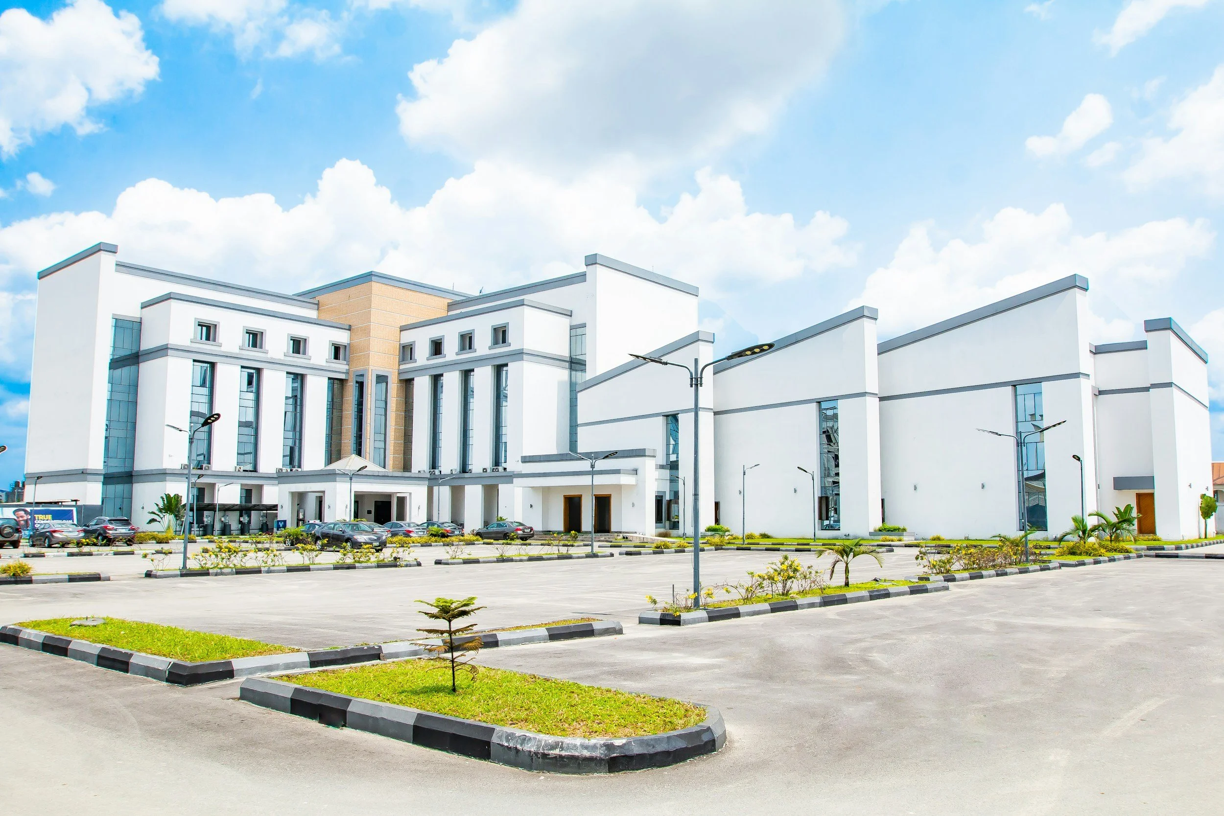
The Intelligent Health City-Establishing the Information Foundation for Healthcare Infrastructure- From Design to Intelligent Operations
The intelligent hospital begins before the hospital is built. As healthcare campuses become larger, more specialized and increasingly technology-enabled, owners need more than BIM, CDEs or digital twins, they need a trusted information foundation that connects design, construction, commissioning, operations and long-term asset intelligence. This strategic case presents an owner-side approach to establishing that foundation from zero, creating the conditions for intelligent, resilient and AI-ready healthcare infrastructure.
STRATEGIC CASE | EXECUTIVE BRIEFING
THE INTELLIGENT HEALTH CITY
Establishing the Information Foundation for Healthcare Infrastructure- From Design to Intelligent Operations
Application: New Hospitals · Integrated Health Cities · Medical & Research Campuses
Primary Markets: India · GCC · Emerging Global Healthcare Infrastructure
Strategic Role: Owner-Side Infrastructure Information & Intelligence
GeoIntelliX Position: Independent, Vendor-Neutral Infrastructure Information & Intelligence Partner
EXECUTIVE SUMMARY
The next generation of healthcare infrastructure is no longer simply a hospital.
Large healthcare developments increasingly combine multi-specialty hospitals, medical education, research, laboratories, advanced medical technology, digital health, ICT, utilities, logistics, accommodation and extensive campus infrastructure within one highly integrated physical environment.
The physical complexity is visible. The information complexity is not.
Hundreds of organizations may participate. Thousands of professionals may create information. Millions of drawings, models, specifications, submissions, inspections, asset records, commissioning documents and operational datasets may be generated throughout the project.
Yet the owner ultimately inherits one physical asset.
The strategic question is therefore not:
“Have all the drawings, models and documents been delivered?”
It is:
“Can the owner trust the information required to design, construct, commission, operate, maintain, expand and ultimately transform the healthcare asset?” Who ensures that the information created by the entire delivery ecosystem becomes one trusted, structured, interoperable and continuously maintainable information asset for the owner?
This is not simply a BIM question.
It is not simply a CDE question.
It is not simply a GIS question.
It is not a software question.
It is an owner-level infrastructure information and intelligence question.
The information architecture of a major healthcare development must therefore be established before information production begins, governed throughout design and construction, verified against physical reality, transferred into operations and continuously evolved with the asset.
GeoIntelliX establishes this independent owner-side layer.
It connects:
OWNER REQUIREMENTS → INFORMATION STANDARDS → CDE → GIS → BIM → DESIGN → CONSTRUCTION → VERIFICATION → ASSET INFORMATION → COMMISSIONING → OPERATIONS → O&M → INTELLIGENCE
The objective is not to introduce another technology platform.
The objective is to ensure that the owner's information remains trusted, structured, interoperable, traceable, verified and useful throughout the life of the healthcare asset.
The central proposition
BUILD THE INFORMATION ARCHITECTURE BEFORE YOU BUILD THE HOSPITAL.
01 | THE HEALTH CITY IS AN INFORMATION SYSTEM AS WELL AS A PHYSICAL SYSTEM
A modern Health City may integrate five highly interdependent infrastructure environments.
CLINICAL INFRASTRUCTURE
Hospitals, emergency departments, operating theatres, ICUs, laboratories, imaging, pharmacies, specialist clinical facilities and patient-care environments.
MEDICAL & TECHNICAL INFRASTRUCTURE
Medical gases, critical HVAC systems, clean environments, electrical distribution, specialist engineering systems, biomedical infrastructure and technical support systems.
DIGITAL INFRASTRUCTURE
Data centres, ICT networks, ELV systems, BMS, clinical technology, cybersecurity infrastructure and enterprise technology environments.
CAMPUS & CIVIL INFRASTRUCTURE
Land, roads, parking, drainage, utilities, energy systems, water infrastructure, security, logistics and external networks.
ACADEMIC & RESEARCH INFRASTRUCTURE
Medical universities, teaching facilities, simulation centres, research laboratories, innovation facilities and associated infrastructure.
These environments are physically interconnected.
Their information must be interconnected as well.
A modification to one system may affect several others.
A new clinical building may alter utility demand.
A new medical technology installation may affect electrical, HVAC, structural and ICT requirements.
A refurbishment may affect fire safety, medical gases, infection-control requirements and operational continuity.
The information environment must therefore reflect the relationships between spaces, systems, assets, infrastructure and operations not merely individual models and documents.
THE INFORMATION ECOSYSTEM:
A major healthcare development typically involves:
Healthcare owner / authority
Investment and executive leadership
Medical planners
Lead architect
Civil, structural and MEP consultants
Specialist healthcare consultants
PMC
Main contractor
MEP and specialist subcontractors
Medical equipment OEMs
ICT / ELV / cybersecurity teams
Commissioning specialists
Facility management
Clinical engineering
Regulatory authorities
When delivery stakeholders utilize disparate software tools, unaligned geodetic coordinate systems, non-standard naming conventions, and proprietary asset identifiers, the project generates multiple incompatible versions of the truth. This creates operational liabilities:
Unverified As-Builts: Submittals that reflect design intent rather than laser-verified field installations.
Disconnected GIS & BIM: Isolated utility maps detached from indoor building spaces and asset registries.
Operational Rediscovery: Facility management teams wasting up to 20% of operational labor manually verifying physical conditions prior to routine maintenance.
Information Obsolescence: Operational records decoupling from physical reality within 24 to 36 months of handover.
02 | THE OWNER'S INFORMATION CHALLENGE
A major healthcare development typically involves:
Healthcare owner / authority
Investment and executive leadership
Medical planners
Lead architect
Civil, structural and MEP consultants
Specialist healthcare consultants
PMC
Main contractor
MEP and specialist subcontractors
Medical equipment OEMs
ICT / ELV / cybersecurity teams
Commissioning specialists
Facility management
Clinical engineering
Regulatory authorities
When delivery stakeholders utilize disparate software tools, unaligned geodetic coordinate systems, non-standard naming conventions, and proprietary asset identifiers, the project generates multiple incompatible versions of the truth. This creates operational liabilities:
Yet the owner requires one coherent information environment.
Without a deliberate owner-side architecture, the project can gradually develop:
Multiple versions of information
Inconsistent naming and classification
Disconnected GIS and BIM
Uncontrolled revisions
Incomplete asset attributes
Unverified as-built information
Disconnected commissioning records
Weak relationships between rooms, systems and assets
Difficult operational handover
Information that becomes increasingly difficult to maintain
The issue is not that individual organisations fail to produce information.
The issue is that information produced by many organisations does not automatically become one trusted owner asset.
03 | THE INFORMATION CONTINUITY GAP
The information continuity challenge begins long before handover.
An architect develops a model.
An engineer develops systems.
A contractor produces shop drawings.
A specialist contractor modifies an installation.
An OEM provides equipment information.
Commissioning teams generate test and certification records.
Facility management receives operational documentation.
Each stage adds information.
Each stage can also introduce change.
The critical question is whether information remains continuously connected to:
Owner requirements
Physical reality
Other information systems
Operational requirements
Future lifecycle requirements
If those relationships are not governed from the beginning, the project can reach completion with a large volume of information but limited confidence in its operational usefulness.
The strategic distinction
Information volume is not information value.
The objective is not to collect the largest possible quantity of project information.
It is to establish the right information, at the right time, to the required quality, with clear responsibility and continuous traceability.
04 | THE QUESTION EVERY HEALTHCARE OWNER SHOULD ASK
The traditional project question is:
“Have we received the drawings, BIM models and O&M manuals?”
The intelligent-owner question is:
“Can we trust the information required to operate this healthcare infrastructure?”
That requires six controls from the beginning.
01 | WHAT
What information must be created, delivered, verified and maintained?
02 | WHO
Who is responsible for creating, reviewing, approving and maintaining it?
03 | WHEN
At what project milestones must information satisfy defined requirements?
04 | HOW
What standards, classifications, naming conventions, formats and exchange protocols apply?
05 | QUALITY
How will digital information be checked against design requirements and physical reality?
06 | CONTINUITY
How will information remain current as the facility changes throughout its operational life?
This changes information from an end-of-project deliverable into a managed infrastructure asset.
05 | THE OWNER-SIDE INFORMATION & INTELLIGENCE LAYER
GeoIntelliX operates as an independent Owner-Side Infrastructure Information & Intelligence Layer.
It does not replace the architect.
It does not replace the engineer.
It does not replace the PMC.
It does not replace the contractor.
It does not replace the BIM team, CDE provider, GIS platform, CAFM/EAM system or technology vendor.
It establishes the owner's information architecture and assurance framework within which these participants operate.
THE MODEL
HEALTHCARE OWNER
↓
GEOINTELLIX
OWNER-SIDE INFORMATION & INFRASTRUCTURE INTELLIGENCE LAYER
↓
DESIGN · ENGINEERING · CONSTRUCTION · SPECIALIST DELIVERY · OEMs · COMMISSIONING
↓
VERIFIED INFORMATION
↓
OPERATIONAL INFORMATION
↓
INFRASTRUCTURE INTELLIGENCE
The distinction is fundamental.
GeoIntelliX is not another software platform competing with established technology providers.
Its role is to make the information ecosystem work for the owner.
06 | ESTABLISH THE INFORMATION FOUNDATION BEFORE DESIGN
The greatest strategic value is created before information fragmentation begins.
Before major design production starts, the owner should establish:
STAGE 01 | PRE-DESIGN
OIR → AIR → PIR
Define what information the owner will require from the project and the future operational environment.
STAGE 02 | DESIGN
Establish:
ISO 19650 → CDE → BIM standards → GIS standards → asset standards → room/space standards → information delivery requirements
STAGE 03 | CONSTRUCTION
Control:
submissions → coordination → QA/QC → revisions → RFIs → inspections → asset information → field changes
STAGE 04 | COMMISSIONING
Establish:
verified as-built → asset information → testing → certification → room information → O&M information
STAGE 05 | INITIAL OPERATIONS
For the first 1–2 years, focus on stabilising the information environment alongside actual facility operations.
STAGE 06 | O&M
For the subsequent 10-year O&M horizon, continuously maintain and exploit the information environment for:
maintenance → modifications → asset renewal → risk management → performance → capital planning
Strategic Roadmap
INFORMATION GOVERNANCE BEFORE INFORMATION PRODUCTION
The most important intervention occurs before information volume becomes large.
GeoIntelliX establishes:
OIR - ORGANISATIONAL INFORMATION REQUIREMENTS
What information does leadership require to govern the healthcare development and future enterprise?
AIR - ASSET INFORMATION REQUIREMENTS
What information will be required to operate, maintain, renew and manage each significant asset?
PIR - PROJECT INFORMATION REQUIREMENTS
What must the delivery ecosystem create and deliver to satisfy those requirements?
These requirements should flow into:
Architect Appointments → Consultant Contracts → Contractor Packages → Specialist Contracts → OEM Requirements → Commissioning → Handover → Operations
THE PRINCIPLE
Information requirements must become contractual requirements not end-of-project requests.
07 | THE COMMON DATA ENVIRONMENT - MORE THAN DOCUMENT STORAGE
The CDE should be established as controlled information infrastructure for the project.
A mature information environment progresses through defined states:
WORK IN PROGRESS → SHARED → REVIEWED → APPROVED → PUBLISHED → ARCHIVED
But the strategic requirement goes further.
The CDE should connect, as appropriate:
BIM · GIS · DOCUMENTS · RFIs · SUBMISSIONS · INSPECTIONS · APPROVALS · ASSET INFORMATION · COMMISSIONING · HANDOVER
The objective is:
One governed information environment across the delivery ecosystem.
A CDE licence alone does not create information governance.
The architecture, rules, responsibilities and assurance mechanisms around the CDE do.
08 | ESTABLISH THE PHYSICAL REALITY
Before the digital environment becomes deeply dependent on design information, the project should establish an authoritative spatial foundation appropriate to its scale and risk.
Depending on project requirements, this may include:
Geodetic Control · Topographic Survey · LiDAR · GIS · GPR · EML · Reality Capture
The resulting baseline establishes a common spatial reference for:
Land → Campus → Building → Floor → Room → System → Asset
This becomes the spatial backbone connecting the healthcare campus.
The principle
Digital information should be established against a trusted understanding of physical reality.
09 | GIS + BIM + ASSET INFORMATION
BIM does not represent the complete healthcare infrastructure environment.
GIS provides
Land · Campus · External Utilities · Roads · Drainage · Infrastructure Context
BIM provides
Building · Structure · MEP · Systems · Spaces
Asset information provides
Equipment · Identifiers · Attributes · Maintenance · Lifecycle Information
Together:
CAMPUS → BUILDING → SPACE → SYSTEM → ASSET → OPERATION
This relationship becomes particularly important in large hospital campuses where infrastructure extends far beyond the building envelope.
The objective is not to make GIS and BIM identical.
It is to establish the relationships and information architecture through which they can operate together.
10 | QUALITY MUST BE CONTINUOUS
Information quality should not be discovered at handover.
GeoIntelliX establishes progressive information assurance across the lifecycle.
Checks may include:
Geometry
Coordinates
Naming
Classification
Required Attributes
Model Integrity
Coordination
Clash Detection
Maintainability
Information Completeness
Defined Design Rules
Regulatory Requirements
Where appropriate, automated and AI-assisted validation can support:
Design Review · Document Checking · Completeness Analysis · Anomaly Detection · Compliance Assessment
The principle is:
SUBMISSION → CHECK → CORRECT → ASSURE → APPROVE
The earlier an information defect is identified, the greater the opportunity to prevent it from becoming a construction, commissioning or operational issue.
11 | FROM AS-DESIGNED TO AS-VERIFIED
The contractor's drawing is not automatically the physical truth.
Healthcare facilities contain substantial infrastructure that subsequently becomes concealed.
Critical information should therefore be progressively verified at appropriate construction gateways.
BEFORE CLOSURE
MEP · Medical Gases · Electrical Containment · ICT · Embedded Services
BELOW GROUND
Utilities · Drainage · Buried Infrastructure
PLANT & CRITICAL AREAS
Equipment · Connections · Access · Maintenance Clearances
FINAL HANDOVER
Field Verification → Approved Models → Asset Information → O&M Information
The strategic objective is:
AS-VERIFIED INFORMATION
- not simply contractor-submitted as-built documentation.
Existing records provide evidence of what was documented. Verification establishes confidence in what exists.
12 | THE DIGITAL ROOM BOOK
Healthcare infrastructure is fundamentally space-dependent.
The room can become a powerful information object connecting:
ROOM ID → CLINICAL FUNCTION → SYSTEMS → EQUIPMENT → DOCUMENTS → MAINTENANCE
This enables operational teams to understand:
What exists
Where it exists
What it supports
What information is associated with it
What maintenance or operational requirements apply
The result is a structured relationship:
ROOM → SYSTEM → ASSET → INFORMATION → OPERATION
For a large healthcare campus, this can become one of the most valuable bridges between design information and operational reality.
13 | COMMISSIONING IS THE TRANSITION TO OPERATIONAL INTELLIGENCE
Handover should not be a document-transfer exercise.
It should establish an operational information environment containing, as applicable:
Verified Asset Register
Asset Information Model
Room Information
BIM
GIS
O&M Manuals
Equipment Records
Warranties
Test Certificates
Commissioning Records
Maintenance Requirements
Approved Changes
Training Records
The transition becomes:
PROJECT INFORMATION
↓
VERIFIED INFORMATION
↓
OPERATIONAL INFORMATION
↓
INFRASTRUCTURE INTELLIGENCE
This is the difference between:
Document Handover
and
Information Handover.
14 | THE FIRST YEARS OF OPERATIONS MATTER
The first operating period provides something construction cannot:
real operational evidence.
The facility begins generating information about:
Asset Changes · Maintenance · Failures · Inspections · Modifications · Operational Observations · Energy Performance · System Behaviour
This information can be progressively connected back to the asset information environment.
The objective is to establish a reliable relationship between:
PROJECT INFORMATION → PHYSICAL ASSET → OPERATIONAL REALITY
This is the point at which the information environment begins to mature into an infrastructure intelligence environment.
15 | THE O&M INTELLIGENCE HORIZON
Once operational information becomes sufficiently trusted and connected, the owner can progressively move beyond document retrieval toward infrastructure intelligence.
ASSET INTELLIGENCE
Which assets are critical?
Which require renewal?
Which assets are approaching significant lifecycle decisions?
SPATIAL INTELLIGENCE
What systems, spaces and infrastructure are affected by a proposed modification?
MAINTENANCE INTELLIGENCE
Where are recurring failures occurring?
What relationships exist between assets, systems and maintenance events?
RISK INTELLIGENCE
Where are the highest operational vulnerabilities?
Which infrastructure dependencies could affect clinical continuity?
PERFORMANCE INTELLIGENCE
How are buildings, systems and infrastructure performing?
CAPITAL INTELLIGENCE
Where should future investment be directed?
This enables a progressive transition:
REACTIVE O&M → INFORMATION-DRIVEN O&M → PREDICTIVE INFRASTRUCTURE MANAGEMENT
16 | FROM INFORMATION TO AI
AI becomes strategically valuable only when the underlying information can be trusted.
The progression is:
TRUSTED REALITY
↓
GOVERNED INFORMATION
↓
CONNECTED INFORMATION
↓
ANALYTICS
↓
AUTOMATION
↓
AI
↓
PREDICTIVE INTELLIGENCE
Potential applications can include:
Predictive Maintenance
Asset Criticality Analysis
Design-Risk Detection
Capital Renewal Forecasting
Energy Optimisation
Space Intelligence
Infrastructure Risk Prediction
AI-Assisted Decision Support
The principle is critical:
AI should build upon trusted infrastructure information—not compensate for its absence.
17 | THE DIGITAL TWIN PRINCIPLE
A digital twin should not be treated as the starting point.
It is the outcome of information maturity.
PHYSICAL REALITY
↓
GEOSPATIAL BASELINE
↓
GOVERNED INFORMATION
↓
GIS + BIM + ASSET DATA
↓
VERIFIED AS-BUILT
↓
OPERATIONAL SYSTEMS
↓
ANALYTICS
↓
AI
↓
OPERATIONAL DIGITAL TWIN
The principle
A digital twin without trusted underlying information is principally a visualisation—not an operational intelligence system.
18 | TECHNOLOGY INDEPENDENCE
The technology environment of a major healthcare development will evolve.
BIM platforms will change.
CDE platforms will change.
GIS technologies will evolve.
EAM and CAFM environments will change.
AI capabilities will advance rapidly.
The owner's information architecture must therefore outlive individual technology products.
GeoIntelliX establishes a vendor-neutral information architecture, supported where appropriate by open standards and interoperability mechanisms such as:
IFC · COBie · ISO 19650 · Structured Classifications · Open APIs · Data Exchange Standards
The principle is simple:
Software applications are transient. The owner's core information architecture must endure.
GeoIntelliX does not prescribe a proprietary technology stack.
It establishes the architecture within which appropriate technologies can be selected, configured, integrated or developed.
19 | CAPABILITY IS PART OF THE INFRASTRUCTURE
Technology cannot compensate for weak organisational capability.
A major Health City requires information capability across the entire ecosystem.
EXECUTIVE LEADERSHIP
Information Governance · Strategic Risk · Infrastructure Intelligence
PROJECT LEADERS
OIR · AIR · PIR · CDE · Information Assurance
DESIGN TEAMS
BIM · Standards · Coordination · Information Delivery
CONTRACTORS
Digital Delivery · CDE · QA/QC · Field Information
FM & CLINICAL ENGINEERING
Asset Information · CAFM/EAM · Lifecycle Management
The objective is not:
“Train people on software.”
It is:
“Build the organisational capability to govern infrastructure information.”
20 | WHAT CHANGES FOR THE OWNER?
TRADITIONAL APPROACH
BIM as a project deliverable.
INFORMATION-LED APPROACH
BIM as part of an integrated information ecosystem.
TRADITIONAL APPROACH
CDE as document storage.
INFORMATION-LED APPROACH
CDE as information-governance infrastructure.
TRADITIONAL APPROACH
Handover as document collection.
INFORMATION-LED APPROACH
Handover as operational readiness.
TRADITIONAL APPROACH
Contractor as-built.
INFORMATION-LED APPROACH
Verified as-built.
TRADITIONAL APPROACH
Separate GIS and BIM environments.
INFORMATION-LED APPROACH
Connected spatial information.
TRADITIONAL APPROACH
Manual, late-stage QA/QC.
INFORMATION-LED APPROACH
Progressive digital validation.
TRADITIONAL APPROACH
Reactive O&M.
INFORMATION-LED APPROACH
Information-driven O&M.
TRADITIONAL APPROACH
Digital twin first.
INFORMATION-LED APPROACH
Trusted information first.
THE OWNER-SIDE ADVANTAGE
The strategic value is not simply better documentation.
It is the ability to make better decisions throughout the asset lifecycle.
21 | THE OWNER-SIDE ADVANTAGE
The strategic value is created across the entire lifecycle.
BEFORE DESIGN
Requirements → Standards → Spatial Foundation → Information Architecture
DURING DESIGN
Coordination → Information Assurance → Design Intelligence
DURING CONSTRUCTION
Controlled Information → QA/QC → Reality Verification
AT COMMISSIONING
Verified Information → Asset Information → Operational Readiness
DURING OPERATIONS
Information Continuity → Asset Visibility → Operational Intelligence
DURING O&M
Performance → Risk → Maintenance → Capital Planning
DURING EXPANSION
Trusted Existing Information → Faster Understanding → Better Design Decisions
The owner does not have to repeatedly reconstruct knowledge about its own infrastructure.
The infrastructure remembers.
22 | WHY THE INFORMATION ARCHITECTURE MUST START AT ZERO
The greatest value is created before the project becomes information-intensive.
Early owner-side engagement enables:
Requirements before tender
Standards before model production
CDE before information proliferation
Geospatial baseline before design dependency
Asset requirements before procurement
QA/QC before errors propagate
Reality verification before closure
Operational requirements before handover
AI readiness before technology investment
This is why the intervention should begin at pre-design, not at handover.
By the time a major healthcare campus reaches commissioning, the information architecture should already be mature.
23 | THE LIFECYCLE ROADMAP
01 | PRE-DESIGN
OIR · AIR · PIR · Information Governance
↓
02 | DESIGN
ISO 19650 · CDE · GIS / BIM Standards · Asset Standards · Room & Space Standards
↓
03 | CONSTRUCTION
Coordination · QA/QC · Controlled Revisions · Field Information · Reality Verification
↓
04 | COMMISSIONING
Verified Information · Asset Information · Testing · Certification · Operational Readiness
↓
05 | INITIAL OPERATIONS
Information Stabilisation · Operational Calibration · Change Capture
↓
06 | O&M
Asset Intelligence · Risk · Performance · Maintenance · Capital Planning
↓
07 | FUTURE
Automation · AI · Predictive Intelligence · Operational Digital Twin
24 | THE EXECUTIVE IMPERATIVE
A major healthcare development may take years to design and construct.
The information created during those years may remain relevant for decades.
The strategic failure is therefore not simply an incorrect drawing.
It is the loss of information continuity between:
DESIGN → CONSTRUCTION → COMMISSIONING → OPERATIONS → O&M → EXPANSION
The owner should not wait until handover to discover whether its information is:
complete · interoperable · traceable · verified · operationally useful
The information architecture must be established before the information is created.
It must be governed while the facility is designed and constructed.
It must be verified against physical reality.
It must become operationally useful.
And it must evolve with the asset.
25 | THE GEOINTELLIX PROPOSITION
BUILD THE INFORMATION ARCHITECTURE BEFORE YOU BUILD THE HOSPITAL.
GeoIntelliX establishes the independent owner-side layer connecting:
OWNER REQUIREMENTS
→ INFORMATION GOVERNANCE
→ GEOSPATIAL REALITY
→ GIS
→ BIM
→ DESIGN
→ CONSTRUCTION
→ VERIFICATION
→ ASSET INFORMATION
→ COMMISSIONING
→ OPERATIONS
→ O&M
→ ANALYTICS
→ AI READINESS
The result is not simply a better BIM model.
It is not simply a CDE.
It is not simply a digital twin.
It is a trusted infrastructure information environment capable of becoming an infrastructure intelligence system.
REALITY → INFORMATION → INTELLIGENCE → FORESIGHT → DECISION
THE 2035 HEALTH CITY
The intelligent Health City will not be defined simply by advanced medical technology, artificial intelligence, robotics or digital systems.
Its long-term intelligence will depend on something more fundamental:
whether the owner can continuously understand the physical infrastructure on which the healthcare enterprise depends.
The hospital of the future must therefore be designed with two foundations:
A physical foundation for healthcare delivery.
An information foundation for infrastructure intelligence.
The first makes the hospital possible.
The second allows the owner to understand, operate, protect, maintain, expand and continuously improve it.
The intelligent hospital begins before the hospital is built.
GEOINTELLIX PERSPECTIVE
GeoIntelliX believes the next generation of healthcare infrastructure requires a fundamental shift:
FROM PROJECT INFORMATION
to
OWNER INFORMATION
to
TRUSTED INFRASTRUCTURE INFORMATION
to
INFRASTRUCTURE INTELLIGENCE
The strategic objective is not to create more digital information.
It is to ensure that the information created across the entire delivery ecosystem becomes a trusted, enduring and intelligence-ready asset for the owner.
THE PRINCIPLE
Know the reality.
Govern the information.
Verify what is built.
Connect the asset.
Understand the operation.
Anticipate what comes next.
GeoIntelliX Global
Building the Information Foundation of the Intelligent Health City.